ARCHITECTURAL GHOSTS OF VIRGINA #01

Vernacular-Architecture_12112010_0001.gif

All that remains of a post-civil war rural cabin up behind my house in Charlottesville, Virginia. 

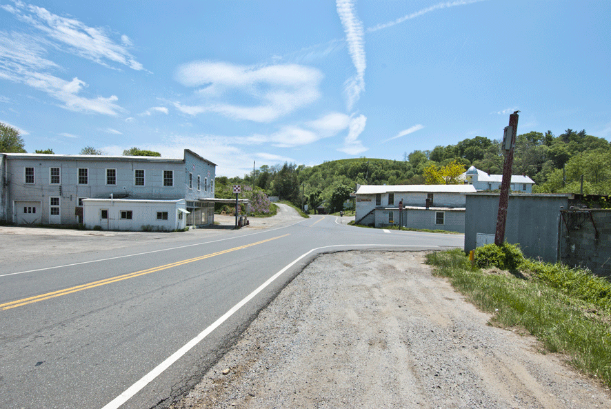
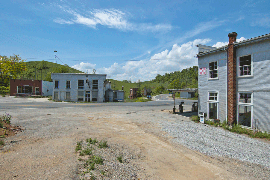
Every since I arrived in Charlottesville, Virginia in 2004, I’ve spent a great deal of time exploring the back roads, searching out places on my motorcycle that are new to me, and that are often accessible only by four-wheel-drive vehicles or motorcycles like mine. I have a few BMW “Dual Sport” bikes that are built to handle off road conditions, but that also do just fine on the pavement. I’ll probably never exhaust the seemingly endless quantity of fire roads, logging trails, dirt, and partially paved roads that have etched their way across the mountains and through the valleys a day’s ride from Charlottesville, which is just to the east of the Blue Ridge Mountain in west central Virginia. A long day ride west takes me across the Blue Ridge and the Shenandoah Valley out into the Allegheny Mountains and home again. This part of the western edge of Virginia and into West Virginia is the very heart of what is known as Appalachia. Here time seems to have stood still, and the architectural ghosts of Virginia and West Virginia abound.

There are small towns and villages that have their structures, and these can be quite beautiful, unusual, and intriguing, but I’m particularly attracted to the buildings living and deceased that appear in the most remote, lonely, and inhospitable places imaginable out beyond the town limits. These are the hardscrabble places, where life must have been almost unbearable at times, but also sublimely beautiful. It’s a heartbreaking balance. The places I find appear today much as they would have in the 18th, 19th, and early 20th centuries, and that makes the experience of discovery even richer. There is very little to bring the modern visitor into the present.

In this part of my Architectural Blog, I’ll share with you some of what I find, and let you know how you can find these places should you choose to go exploring yourself. You can always contact me for more exacting directions, I’m happy to oblige. But don’t wait too long. Much of what I’ll show here won’t last much longer. These places are deteriorating as I write this. Wood and brick dissolve relatively slowly, but as every year passes, there is less to see of the buildings, and the trees and undergrowth will soon engulf them completely, making them even harder to locate. Luckily, the remains of the old roads usually pass close by these places; to live further out would have been suicidal for the early inhabitants. 

Read on for an introduction to Architectural Ghost #1:

ARCHITECTURAL GHOST #1

Ghosts_04192014_0007.gif

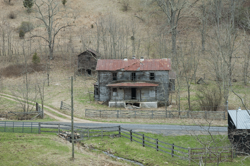
Farmhouse and Outbuildings looking west from route 624, near McDowell, Virginia

Ghosts_04192014_0009.gif

Farmhouse and Outbuilding looking northwest from route 624

Ghosts_04192014_0017.gif

Corner of Farmhouse looking southwest from route 624

Ghosts_04192014_0016.gif

Farmhouse looking west from route 624

I came upon this once beautiful 19th century farm on a ride from the town of McDowell, which is Highland County, Virginia, west of Staunton on route 250, and just east of the town of Monterey. Heading north and west of McDowell up into Jack Mountain on Jack Mountain Road will bring you to this farm, first viewed from up above as you wind down on the road that passes right between the farmhouse and the barn. This is an amazingly charming setting, one of the more serene and tranquil that I’ve found. The house is a common form found throughout Virginia, basically a center entrance “two over two” rectangle, with an added Ell off the back, and a side bay. The farmer’s porch along the front may have been added later. A pair of chimneys flank the center entrance hall and stair, providing heat to each of the four main rooms. The Ell contains the Kitchen, its chimney can be seen poking through the roof.

Ghosts_04192014_0011.gif

Farmhouse showing Ell and pair of Outbuildings looking south on route 624

The rubble stone foundation is largely intact, and the standing seam metal roof has struggled to keep out the rain, but is losing the battle. This is one of those places that teeter on the brink of being able to be saved, but the cost of doing so at this point would be prohibitive for all but the most dedicated and deep-pocketed restorer. No doubt it will continue to dissolve until only the chimney and foundation walls remain. The barn is still in service to someone, and has been maintained to some extent, but the house and the two small sheds behind it have been abandoned to the elements.

Ghosts_04192014_0014.gif

Farmhouse and Outbuildings to the right, Barn to the left, looking south on route 624

Virginia Ghost Town

Mouth of Wilson, Grayson County, Virginia

Looking east along route 58, route 16 heads south to the right 

My first motorcycle trip down the Blue Ridge Parkway in 2004 planted the seed for my future move down to Charlottesville, VA a year later.  I had a series of revelations in the course of that first trip. Some involved profound human interactions I had, and some were based on various observations at a time when my eyes were wide open to this new part of the country. It’s funny how a new place will excite my senses, and equally saddening how that freshness wears off after becoming acclimated to it. On this first trip to Virginia I saw a quote from Marcel Proust on a coffee mug in a gift shop window in Lexington, VA: The only real voyage of discovery lies not in seeking new landscapes, but in developing new eyes with which to perceive them”. Proust had it right, as far as I can see, and I’m inspired ceaselessly to adhere to his maxim.

One of the more moving sights on this first ride through southwestern Virginia was a town named “Mouth of Wilson”, at the North Carolina border, at the junction of routes 58 and 16.  This town looks like many other timeworn places I’ve seen and photographed, but this one stands apart because it’s commercial center appeared to be completely abandoned. I’ve seen many towns in many parts of this country that had a period of prosperity reflected in the town’s architecture, but that progress had left behind. Once formidable buildings are slowly sinking into disrepair, some too far gone to realistically bring back for any current usage. Some of these places were on back roads where traffic had long ceased to flow. But this place, Mouth of Wilson, was right at the “T” intersection of two busy roads- route 58 that runs east west along the border of Virginia and North Carolina, and route 16 that runs south to North Carolina. This is still a rural area, but there was an intermittent flow of traffic on both roads while I spent an hour or so there.

Mouth_of_Wilson_02152014_0003.gif

Former Halsey Farm Service Store, looking northeast on route 58, Mouth of Wilson, VA

There were the usual types of rural vernacular buildings dating from the 19th and 20th centuries: mill buildings, general store, post office, gas station and auto repair shop, a few houses, and misc. commercial buildings. All were in reasonably good condition, and all shared one glaring characteristic- they were abandoned. Even the newest building, the ubiquitous, bland, brick Post Office building was silent and empty. And there wasn’t a soul in sight, anywhere. It reminded me of an early Twilight Zone episode of a man wandering down a dirt road into a town kind of like this one, with no people anywhere to be seen. Cigarettes are burning in ashtrays on diner counters, radios play, faucets drip, and there is no one.

Looking south down route 16, Mouth of Wilson, VA. The remains of the Fields Manufacturing Company woolen mill is on the left

Mouth_of_Wilson_02152014_0005.gif

Looking southeast from route 58 down route 16, Mouth of Wilson, VA 

Mouth_of_Wilson_02152014_0006.gif

Looking east across unidentified structure towards old woolen mill, Mouth of Wilson, VA

Mouth_of_Wilson_02152014_0007.gif

Looking west on route 58 from junction of route 16, Mouth of Wilson, VA. Old water tower to left, unidentifed house on right

Mouth_of_Wilson_02152014_0009.gif

Looking South down route 16 from route 58, Mouth of Wilson, Virginia. Woolen mill to left, old water tower to right

Mouth_of_Wilson_02152014_0010.gif

Looking south down route 16, Mouth of Wilson, VA. Abandoned woolen mill to left

Mouth_of_Wilson_02152014_0011.gif

Looking southeast from route 16, Mouth of Wilson, VA. Remains of woolen mill 

Mouth_of_Wilson_02152014_0012.gif

Looking North on route 16 toward route 58, Mouth of WIlson, VA. 

Mouth_of_Wilson_02152014_0013.gif

Looking north on route 16, Mouth of Wilson, VA. 

Mouth_of_Wilson_02152014_0014.gif

Looking northeast to route 58, Mouth of WIlson, VA. Abandoned Fields Manufacturing Company Store in center, emptly Fields house to right

Mouth_of_Wilson_02152014_0017.gif

Looking South across route 58 down route 16, Mouth of Wilson, VA. Post Office to left, Fields Company Store in center, Halsey Farm Service Store to right

Mouth_of_Wilson_02152014_0018.gif

Looking south from route 58, Mouth of Wilson, VA. Former Post Office center, Fields House to left, Fields Company Store to right

Mouth_of_Wilson_02152014_0019.gif

Looking south from route 58, Mouth of Wilson, VA. Post Office to left, Fields Company Store to right

Mouth_of_Wilson_02152014_0020.gif

Looking South from route 58, Mouth of Wilson, VA. Post office to left, woolen mill in background, Fields Company Store to right

Mouth_of_Wilson_02152014_0021.gif

Looking west along route 58, Mouth of Wilson, VA. Post Office to left, Fields Company Store in center, Halsey Farm Service Store to right

Mouth_of_Wilson_02152014_0023.gif

Looking northwest along route 58, Mouth of Wilson, VA. Fields Company Store to left, Halsey Farm Service Store to right

Mouth_of_Wilson_02152014_0024.gif

Looking north past Halsey Farm Servcie Store, Mouth of Wilson, VA 

Mouth_of_Wilson_02152014_0025.gif

Looking north past corner of Halsey Farm Service Store, Mouth of Wilson, VA 

Mouth_of_Wilson_02152014_0026.gif

Looking east down route 58, leaving Mouth of Wilson, VA

I wandered around this place shooting photos, getting bolder about walking up to and around behind buildings, and no one appeared to ask me what I was doing, or tell me to get lost. I was the only one there. I spent an hour or so shooting, and then packed up and headed east on route 58. I couldn’t shake the image of the place or the terrible feeling of emptiness that it left me with. About 10 miles down the road I found the probable culprit- a huge Walmart store with a parking lot filled with cars. Adjacent to the Walmart were the usual grim collection of soulless commercial structures that, had I been blindfolded and dropped here, I wouldn’t have been able to differentiate from anywhere else in America. 

These photos and the trip that brought me to Mouth of Wilson were taken in May of 2004, and it wasn’t until a few days ago that I came upon a book titled “Lost Communities of Virginia” by Terri Fisher and Kirsten Sparenborg, published by Albemarle Books, 2011, ISBN 978-0-9742707-3-9. There is a chapter on Mouth of Wilson, which is in Grayson County. There is some history of the town in this book and a description of some of the buildings, but no real analysis of how or why the town (or this part of it anyway) was allowed to die. It probably not much more complicated that the example I see repeated over and over in Virginia- a once beautiful old farmhouse in a terrible state of disrepair with a single wide trailer sitting beside it where the occupants now live. There’s not even enough respect to bury the dead and raze the house that is now beyond repair. The little town of Mouth of Wilson had some charm, but clearly no will or interest in preserving any of that. It was cheaper for the townsfolk to let it fall apart and head on over to Walmart. It’s been ten years since I was last in Mouth of Wilson, and I am curious to see what its current status is. I’ll keep you posted…